Massive fault line under the Himalayas is tearing India apart
The Indian Plate, the massive slab of rock carrying the Indian subcontinent, is colliding with Asia.
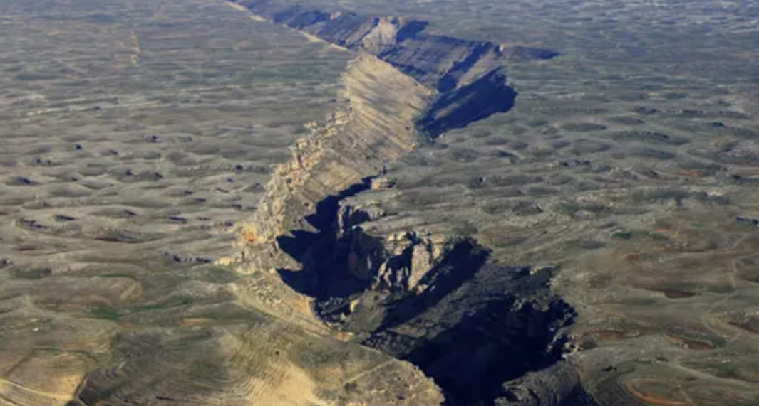
Deep under the Himalayas, the Indian Plate is tearing apart, reshaping mountains and raising earthquake risks in the world’s highest region. (CREDIT: CC BY-SA 4.0)
Beneath the world’s tallest mountains, an extraordinary drama is unfolding. The Indian Plate, the massive slab of rock carrying the Indian subcontinent, is colliding with Asia in a geological contest that has lasted for about 60 million years. This slow-motion crash lifted the Himalayas and Tibetan Plateau skyward, forming the highest peaks on Earth.
But new research reveals that this plate is not simply sliding beneath Tibet in a smooth, predictable fashion. Instead, it is bending, warping, and even tearing apart deep underground.
When Plates Collide
Geologists have long debated what happens to the Indian Plate after it meets Asia. Some thought it slid flatly beneath Tibet like a board under a rug. Others argued it plunged steeply downward, mimicking oceanic plates that dive beneath continents. The latest seismic studies show both ideas are too simple. The Indian Plate isn’t moving in a single, neat motion. It’s breaking into pieces, sometimes peeling away from itself and allowing molten mantle rock to push upward.
West of 90°E longitude, the plate acts like an intact block. Here, the rigid Tibetan lithosphere stops about 100 kilometers north of a major fault zone called the Yarlung-Zangbo suture. This behavior suggests underplating, where the Indian Plate slides smoothly under Tibet’s crust.
But further east, gravity tugs harder on the plate’s dense mantle, pulling it away from its overlying crust. Soft, partially molten rock from the asthenosphere then squeezes into the gap, leaving behind a torn and twisted boundary between the colliding continents.
Why the Picture Has Been So Hard to See
For decades, scientists have struggled to draw a clear map of what lies beneath Tibet. Traditional seismic methods, which use earthquake vibrations to probe Earth’s layers, gave conflicting results. Some models showed the Indian crust extending far under Tibet, while others depicted steep subduction. Different teams looking at the same data often disagreed by more than 50 kilometers in depth.
Related Stories
- San Andreas fault earthquakes may be significantly larger in the future
- Ancient tectonic 'mega plate' rediscovered after 20 million years
The confusion arises because seismic signals at these depths are faint and tricky to interpret. To overcome this, researchers added a tool called shear-wave splitting. This technique studies how seismic waves bend and stretch when they pass through rocks that have been pulled or aligned by tectonic forces. By comparing both methods, scientists built one of the clearest pictures yet of the Indian Plate’s tortured path beneath Asia.
The combined results reveal that the Indian Plate isn’t a single, unbroken slab. Around the Eastern Himalayan Syntaxis, where the mountain chain makes a sharp bend, seismic waves trace circular patterns. These indicate mantle rock flowing around the corner of the collision zone, as if liquid were streaming past a giant boulder in a river. Elsewhere, the plate appears shredded, with some pieces still intact while others detach and roll back into the mantle.
This behavior explains puzzling evidence on the surface. Certain regions of Tibet show thick, stable crust. Others are riddled with faults, stretching, and volcanic activity. Helium gas bubbling from springs adds more clues. Some springs release helium-3, a rare isotope tied to mantle rocks. Its presence far south of expected boundaries suggests a tear in the Indian Plate, letting mantle gases leak upward.
Earthquakes and a Rising Risk
These hidden tears aren’t just a scientific curiosity. They may influence earthquakes in one of the most seismically active regions on the planet. According to Simon Klemperer, a geophysicist at Stanford University, delamination—the process where the plate’s lower mantle peels away—can increase stress in Earth’s crust. That stress could fuel stronger and more frequent quakes across Tibet and the Himalayas.
One major fault, the Cona-Sangri Rift, lies directly above a suspected tear. As the Indian Plate continues to break apart, shifting stresses could trigger future earthquakes here. With millions of people living near the mountains, the stakes are high.
Scientists stress that this research is still evolving. Fabio Capitanio of Monash University calls the data “just a snapshot.” It provides critical evidence, but only a partial view of a complex and ongoing process. More seismic surveys and chemical analyses are needed to capture how the plate continues to deform over time.
Still, the discovery already challenges old assumptions. For decades, geologists believed continents mostly stayed intact during collisions. Douwe van Hinsbergen of Utrecht University described the findings as fundamental: “We didn’t know continents could behave this way, and that is, for solid earth science, pretty fundamental.”
Clues from Ancient Collisions
What’s happening beneath Tibet also reshapes how scientists view other mountain ranges. Geologist Peter DeCelles of the University of Arizona likens the Indian Plate to a manta ray. Its thick continental middle collided head-on with Asia, while its thinner oceanic edges slid under more easily. That uneven geometry likely set the stage for today’s tearing. Similar processes may have shaped the Andes, the Rockies, and even ancient mountain belts now eroded away.
Anne Meltzer, a seismologist at Lehigh University, highlights the global importance. Nearly every continent has been stitched together by past collisions. Understanding India’s ongoing crash helps explain landscapes worldwide, from how mountains rise to why earthquakes strike where they do.
The research draws strength from a large network of seismic stations in southern Tibet—94 in all—that captured waves from distant earthquakes. These records provided a detailed three-dimensional map of the Indian Plate’s jagged outline. The patterns match up with earthquake clusters, mantle gas leaks, and surface faults, giving scientists confidence in their model.
Each new piece of evidence suggests the Indian Plate is far more dynamic than once thought. It bends, stretches, and even splits, reshaping the crust above it. This is not the neat, uniform process once taught in textbooks. Instead, it’s a vivid reminder that Earth’s surface is constantly in motion, molded by hidden forces deep below.
Practical Implications of the Research
The discovery of a tearing Indian Plate has both scientific and human importance. It improves earthquake hazard assessments for people living across the Himalayas and Tibet, where millions are at risk from seismic disasters. The work also helps refine models of how mountains form, guiding studies of other collision zones worldwide.
By showing that continents can warp and tear, the research reshapes our understanding of how Earth builds and destroys its landscapes.
With better data, scientists may one day predict earthquake risks more accurately and prepare communities for the powerful forces still at work beneath their feet.
Note: Materials provided above by The Brighter Side of News. Content may be edited for style and length.
Like these kind of feel good stories? Get The Brighter Side of News' newsletter.