Africa is splitting—and Earth’s sixth ocean is rising from below
This isn’t just another crack in the earth. It has the power to change global maps, reshape political borders, and give rise to Earth’s sixth ocean.
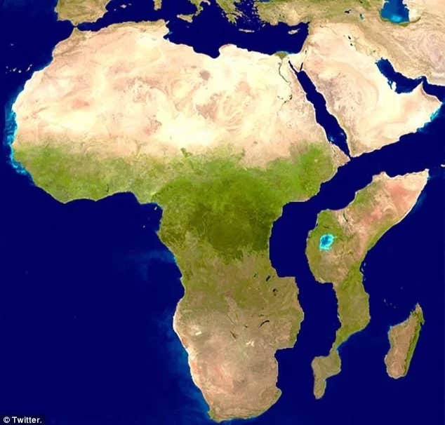
A large crack, stretching several miles, made a sudden appearance recently in south-western Kenya. This is what Africa could look like in millions of years. (CREDIT: CC BY-SA 3.0 / Twitter)
In the dry, sun-scorched deserts of Ethiopia, a slow but astonishing transformation has been unfolding since 2005. A 35-mile-long crack, known as the East African Rift, is gradually tearing through the landscape—marking the early stages of a colossal geological shift.
This isn’t just another crack in the earth. It has the power to change global maps, reshape political borders, and give rise to Earth’s sixth ocean. What may seem like a localized rift is, in fact, the start of something vast and world-altering.
The engine behind this dramatic process lies beneath our feet. Tectonic plates—huge, shifting slabs of the Earth’s crust—float atop a semi-fluid layer called the mantle. Their slow movements have built mountains, split continents, and now, they’re rewriting the future of East Africa.
In this case, the Somalian plate is drifting away from the Nubian plate. That movement mirrors the ancient split between South America and Africa—a process that began hundreds of millions of years ago. But this one is happening right now, and its consequences are already visible.
A paper published in Earth and Planetary Science Letters digs into this tectonic drift. It shows the plates are separating by just a few millimeters each year. The pace may be slow, but the impact is massive. Over time, those few millimeters will reshape the face of the continent.
This split could eventually invite seawater into the heart of Africa. As the crust thins and sinks, the Red Sea and the Gulf of Aden may surge in to flood the Afar region and beyond. What is now landlocked desert could become seafloor in a future African ocean.
Ken Macdonald, a marine geophysicist and professor emeritus from the University of California, paints a vivid picture of what’s coming. “The Gulf of Aden and the Red Sea will flood over the Afar region and into the East African Rift Valley, giving rise to a new ocean,” he explains. “Consequently, this part of East Africa will evolve into its own distinct continent.”
Related Stories
But the rift’s impact won’t stop at geography. It could also rewrite Africa’s economic story. Countries without coastlines today—like Ethiopia and Uganda—might one day have ocean access. That access would open new doors for trade, transport, and economic expansion.
New coastlines could lead to bustling ports, shipping hubs, and vital infrastructure. The shift could bring investment and development to long-neglected areas, helping reshape entire economies. What’s forming in the Ethiopian desert isn't just a geological wonder—it's the seed of a new era.
While this transformation is unlikely to happen in our lifetimes—geological processes operate on timescales far beyond human generations—it highlights the dynamic nature of our planet and its constant evolution. The East African Rift is more than a crack in the desert; it is a glimpse into the Earth's tectonic future and a reminder of the profound forces shaping our world.
This isn’t just a geographic shift; it’s a transformation that will profoundly alter the region’s ecology. Areas that are now arid and desolate could one day teem with marine life as the new ocean forms. Human settlements will have to adapt to these changes, facing both challenges and opportunities as new coastlines develop.
However, it's important to keep in mind that this transformation won’t happen overnight. The complete separation of the African continent and the creation of a new ocean will likely take another 5 to 10 million years.
This timeline serves as a reminder that nature operates on a scale far beyond our lifetimes. While we may not witness the final stages of this transformation, it’s a powerful example of how dynamic our planet truly is.
This ongoing shift is a reminder that Earth’s surface, though it may seem solid and unchanging, is in a constant state of flux. The birth of a new ocean and the reshaping of a continent are just parts of Earth's ever-evolving story—a story that we, as inhabitants of this planet, are fortunate enough to observe and study.
The world's five major oceans
The world’s oceans play a critical role in shaping Earth’s climate, biodiversity, and geological features. Covering about 71% of the Earth’s surface, they are divided into five major oceans: the Pacific, Atlantic, Indian, Southern, and Arctic. Here’s an overview of each ocean along with insights into when they formed in Earth’s planetary evolution.
1. Pacific Ocean
- Size: Largest and deepest ocean, covering more than 63 million square miles and with a maximum depth of about 36,000 feet in the Mariana Trench.
- Formation: The Pacific Ocean began forming about 750 million years ago when the supercontinent Rodinia started breaking apart. It grew as the supercontinents Pangaea and later Gondwana split.
- Fact: The Pacific contains more than 50% of the Earth’s free water and experiences the most tectonic activity, leading to frequent earthquakes and volcanic eruptions.
2. Atlantic Ocean
- Size: Second largest ocean, spanning over 41 million square miles.
- Formation: The Atlantic formed about 200 million years ago during the breakup of Pangaea. The rifting caused the North Atlantic Ocean to open first, followed by the South Atlantic.
- Fact: The Mid-Atlantic Ridge, an underwater mountain range, is a key feature that continues to expand the ocean today as tectonic plates move apart.
3. Indian Ocean
- Size: The third largest ocean, covering about 27 million square miles.
- Formation: The Indian Ocean began forming during the breakup of Gondwana about 180 million years ago as the African and Antarctic plates drifted apart.
- Fact: It’s the warmest ocean, which has a significant influence on weather patterns such as monsoons and the El Niño-Southern Oscillation (ENSO).
4. Southern Ocean
- Size: Fourth largest, encircling Antarctica and spanning around 7 million square miles.
- Formation: Although the waters existed for hundreds of millions of years, the Southern Ocean as a distinct body was designated only in the early 2000s. Geologically, it formed as the Antarctic Plate separated from South America and Australia, allowing a circumpolar current to develop.
- Fact: The Southern Ocean has a unique circulation pattern known as the Antarctic Circumpolar Current, which plays a key role in global heat distribution.
5. Arctic Ocean
- Size: The smallest and shallowest ocean, covering about 5.4 million square miles.
- Formation: The Arctic Ocean has been shaped by tectonic movements over the past 200 million years, but it reached its modern configuration relatively recently during the Pleistocene epoch, about 2.6 million years ago.
- Fact: It has a distinct ecosystem due to its seasonal ice cover, and the ongoing loss of sea ice due to climate change is dramatically affecting the region.
Ocean Formation Timeline:
The Earth’s oceans began forming over 4 billion years ago, shortly after the planet's formation. Water vapor released from volcanic activity condensed to form the early oceans as the planet cooled. Most of the water may have originated from comet impacts and volcanic outgassing. Oceans played a crucial role in creating a stable climate and facilitating the development of early life around 3.8 billion years ago.
The formation of the modern oceans we know today was driven by tectonic processes over hundreds of millions of years, primarily as a result of the shifting and breakup of supercontinents like Rodinia, Pangaea, and Gondwana. These oceans continue to evolve as tectonic plates move, reshaping Earth's surface.
Note: Materials provided above by The Brighter Side of News. Content may be edited for style and length.
Like these kind of feel good stories? Get The Brighter Side of News' newsletter.