New method to map the surface of the moon increases accuracy to unprecedented levels
The surface of the moon and rocky planets, Mars in particular, are of huge interest to anyone trying to explore our solar system.
[Aug 2, 2022: Søren Granat, University of Copenhagen]
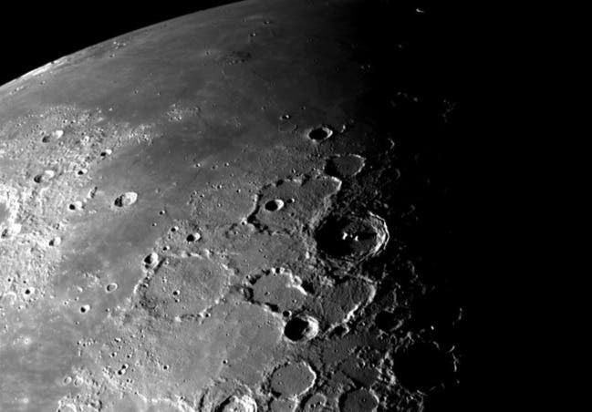
It is obvious from the picture that the surface of the Moon is anything but even. The changes in the topography reveal themselves in the shadows and light. But it is not immediately possible to see how much it changes. How deep are the craters, and how does it look if we need to go into even more detail? (Credit: NASA/JPL)
The surface of the moon and rocky planets, Mars in particular, are of huge interest to anyone trying to explore our solar system. The surface must be known in as much detail as possible, for missions to land safely, or for any robotic vessel to drive across the surface. But until now, the methods to analyze images from e.g. orbiting spacecraft have entailed a huge work load and immense computer power – with limited results.
A project from now former PHD student at the Niels Bohr Institute, University of Copenhagen, Iris Fernandes, has changed that. Studying the limestone formation Stevns Klint in Denmark, she developed a method to interpret shadows in images, so the exact topography can be extracted.The method is even much quicker and less work-intensive. The result is now published Planetar
Human space exploration entails high levels of safety – so precise images of the terrain are adamant
The topography of any surface will create shades, when the sunlight hits it. We can clearly see the shades in the pictures of e.g. the Moon, but we don’t know the elevation of the terrain. So we can see the topography changes, but not how much! It is necessary to be able to see even very small features to ensure safe landing or movement of e.g. a rover. Not to mention the safety of astronauts.
If a rover can’t see details, it could get stuck in sand surfaces or hit rocks – and being able to see interesting geological formations to find rich geological environments for research purposes is also of great importance.
Related Stories
Former limitations in topography assessment have now been largely eradicated
When satellites orbit a planet, they can take pictures in reasonable quality of the surface. But in order to establish an interpretation of the exact topography, good enough for landing the hugely expensive equipment or perhaps even astronauts, a lot of ad hoc information still needs to be processed.
The method of using the shades existed before, but it was computationally inefficient, and still had to rely on assumptions. The new method uses a much more direct and precise calculation, it doesn’t rely on a whole set of parameters to be fed into the computer, and it can even calculate the uncertainties and the accuracy.
“This method is fast, it is precise and it doesn’t have to rely on any assumptions. Previously”, Iris Fernandes says, “if you posed the question: How precise is the assessment of the topography – there really wasn’t a satisfactory answer.
Now the precise topography is revealed, and we can even quantify the uncertainties”.
Lunar landforms with illumination incidence angle and azimuth angle (left (1)) and incidence angle and azimuth angle (right (2)) from LROC (NASA/GSFC/Arizona State University).
Scientific curiosity can lead you to surprising places
“I was involved in a project where we wanted to use pictures from Stevns Klint to model patterns in the surface. I even presented this method in a conference in L.A. But the shades presented a challenge, because the algorithm “saw” the shades as geological features.
It created a bias in the model. We needed to find ways to remove the shades, in order to remove the bias.
Fig. 1. A) Topography of the area used for the numerical example from LOLA (NASA/PDS/MIT). The terrain is generated from a set of LOLA-based model, which in this test plays the role of the “unknown” high-resolution map. B) Synthetic low-resolution topography, 40 times down-scaled. C) Smoothed low-resolution topography with a high number of pixels. This surface was used as an a-priori ‘best guess' of the topography in the numerical test of our algorithm
I was always interested in planets, and I knew the surface of the moon was being studied. There aren’t many disturbing features on the Moon, so it was ideal for removing the bias.
Computed high-resolution elevation map
When we filtered away the shades, we could see what they were “hiding”, so to speak – the surface shapes”, Iris Fernandes explains.
Resolution of existing images presented a new problem – and a new approach
When work on the Moon started, the discrepancy of the different resolutions in images and the topography data turned out to be tremendous. A new problem appeared, in other words. “How could we combine different sources of data in different resolutions?
It presented a huge mathematical problem – and this is really what the study is about.
This is where former research had come to a stop. What we did differently than former attempts to solve this, was that we focused on the mathematics and narrowed it down to a challenging mathematical equation. Basically, to see if this equation could solve the problem.
And it did”, Iris Fernandes smiles. “You could say that we, my supervisor, Professor Klaus Mosegaard and I, found the mathematical key to a door that had remained closed for many years”.
The way forward
The focus now is improving the method even more. Wherever there are data available on rock-formation in the solar system, like the Moon, Mars, asteroids or the like, the method can be applied to extract precise topographic details.
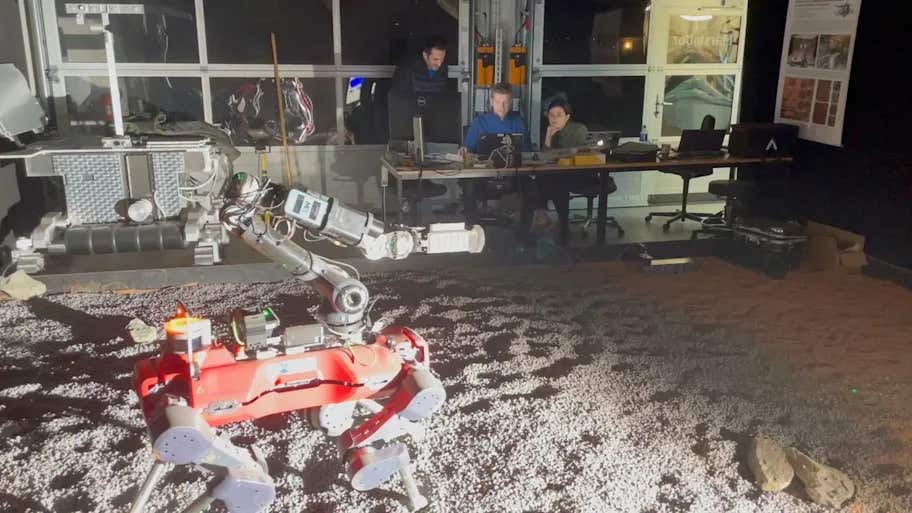
The images used for this task, can be images from satellites or even the rovers themselves, presently on the ground on Mars - or any mobile robot in the future.
The purposes for achieving correct topographic analysis can be different, it could be the safety of the equipment or astronauts or finding geologically interesting sites.
There is a wide array of possible applications, in other words. “It is a sort of computer vision thing”, Iris Fernandes says: “When, for instance, a robot has some form of machinery to interact with the environment, the method can help in navigation or the “eye-hand coordination”, because it is less computational “heavy” and thus faster.
I’m just speculating now, but an interesting feature could be assessing the roundness of little rocks, in order to find former presence of water.
The method shows data for us as humans in a way that we understand intuitively – like images of the roundness of stones, which is very easy to interpret”.
Note: Materials provided above by University of Copenhagen. Content may be edited for style and length.
Like these kind of feel good stories? Get the Brighter Side of News' newsletter.