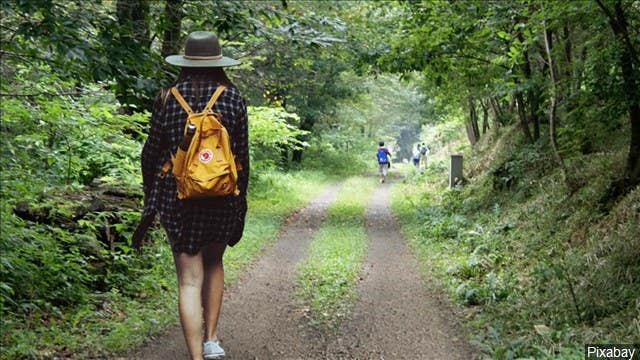
New mobile app provides real-time information to avoid crowded hiking trails
Hiking season is underway in the Pacific Northwest and there’s a new app for outdoor enthusiasts looking to explore popular trails
[June 14, 2021: Jordyn Siemens]
Hiking season is underway in the Pacific Northwest and there’s a new app for outdoor enthusiasts looking to explore some of Washington State’s most popular trails.
“We had this pandemic that created this need to go outside,” explained Mat Lyons, president of Trails, Recreation, Education, Advocacy, Development, or TREAD, a non-profit with a primary goal of connecting people who care for and use public lands.
Together with the Washington Tourism Alliance and Dharma Maps, TREAD recently released its TREAD Map App pilot program, which will provide real-time trail and recreational data, updates and advisories throughout spring and summer 2021 in Central Washington. The app is currently functional in Kittitas, Grant, Douglas, Chelan, and Okanagan counties, where heavy public lands use is expected during the summer season.
Last year, while looking for ways to have fun while social distancing, tons of people flocked to Central Washington to see natural sights, but in some places, the crowds became a problem.
“We know that certain trailheads were loved to death. Others and other recreational spots didn’t see as much business as communities around them would have liked,” said David Blanford, executive director of the Washington Tourism Alliance.
The Washington Tourism Alliance has partnered with the creators of the TREAD Map App to help manage the flow of visitors and protect trails throughout the state, like Stuart Lake Trailhead near Leavenworth, the gateway to the Enchantments and Colchuck Lake.
“That trail has gone from a single track trail now to double its width because there’s so much traffic you’re actually passing people all the time,” Lyons said.
Now, local land managers are involved in the app’s rollout, issuing their own alerts for visitors of the trails they patrol.
“Us telling them what to expect when they get here and explain, ‘Hey if the parking lot is full, maybe you can have a plan B?’ And then we can suggest, ‘Five miles from here is another trailhead. Ten miles from here there’s another.’ That’s very hyper-local information to that one spot, and they know that and the rest of us don’t,” Lyons said.
Despite its functionality, Lyons said the app is not for the “trail blazer.” Unlike some other popular recreation apps, you can’t record your own track or deviate from legal trails.
“We have the public back-end that is giving the real-time information and the authentic information,” he said.
That includes filters for trail usage and camping access. There are multiple map layers that users can turn on and off. There’s even information on air quality and real-time wildfire boundaries.
Lyons said the app is updated as soon as land managers increase their available maps.
There’s also information from other users that offers real-time updates about amenities and trail conditions.
“You come across a tree that’s down, you can literally pull up the app, hit a button that says ‘Tree down,’ and now everyone knows the tree’s down,” Lyons explained.
Even posts from nearby businesses will appear on the app’s community calendar. The WTA hopes this could help bring customers to small-town businesses throughout the state.
“Give back to those local places so they can use some dollars to help enhance their assets and protect them even more,” Lyons said. “When you’re educating everyone and people are protecting the places they love to visit, that’s what it’s all about.”
The WTA is encouraging people to use the app through marketing campaigns and said the more people use and engage with the app, the better the user experience will be. They said the app will soon span the entire Evergreen State.
The app is available for IOS at the Apple App Store or for Android through Google Play.
Like these kind of feel good stories? Get the Brighter Side of News' newsletter.
Tags: #New_Innovations, #Exercise, #Hiking, #The_Brighter_Side_of_News