Polar vortex shift brings colder weather to the western U.S.
New research reveals how polar vortex shifts continue to send Arctic cold into parts of the U.S., even as winters warm overall.
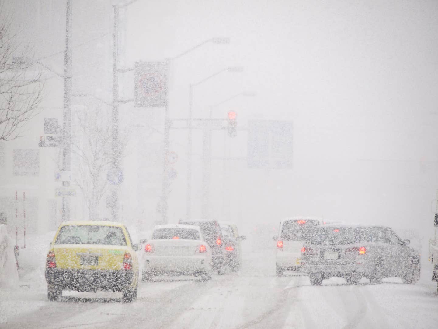
The polar vortex explains why extreme cold still grips parts of the U.S. despite warmer winters overall. (CREDIT: Shutterstock)
Bitingly cold Arctic air keeps pummeling the U.S. with ruthless cold snaps—despite warming winters nationwide. A study explains why: the solution lies far above your head, in the upper atmosphere where the polar vortex resides.
Two recurring cycles within this vortex have been discovered by a group of researchers that channel extreme cold to different regions of the country. Depending on which direction the vortex goes, parts of the region freeze and others go without the chill. These findings account for why cold snaps like the 2021 cold snap that battered Texas remain possible in a warming world.
The study reveals how the stratosphere—a layer of the atmosphere above 10 miles—is capable of shaping winter weather in the continental U.S.
What Is the Polar Vortex?
The polar vortex is a broad, fast ribbon of cold air that encapsulates the Arctic high in the stratosphere. Stable, it confines cold air near the North Pole. Unstable, it is rocked and stretched out and pushes cold Arctic air deep into mid-latitudes.
This study focused on the function of change in the location and shape of the vortex in where cold-weather precipitation falls in the United States. As Hebrew University's Prof. Chaim Garfinkel and colleagues found, it's not necessarily whether or not the vortex deteriorates—it's how it deteriorates.
Two Vortex Patterns, Two Cold Zones
The study is led by researchers from institutions including MIT, the University of Massachusetts, Atmospheric and Environmental Research (AER), the University of Leipzig, and the Woodwell Climate Research Center.
The researchers identified two different forms of the abated vortex, both related to different weather in the United States. When the upper-level vortex is displaced to western Canada in the first type, it pushes Arctic air that moves down into the Northwestern U.S., i.e., Montana, Idaho, and Washington. The vortex in this state becomes "stretched," warping the usual circulation and damaging the stream flow of the jet stream.
The second configuration shortens the vortex into the North Atlantic. This imposes severe cold on the Central and Eastern U.S., all the way down as far south as the Plains, Midwest, and sometimes the Southeast. Both of these are a stretched vortex and abnormally acting atmospheric waves.
In every case, frigid air surges out of the Arctic and travels thousands of miles south, transforming what might otherwise have been a warm winter week into a deep freeze. "The public hears a great deal about the 'polar vortex' when it is severe, but we wanted to know more and discover how changes in this vortex affect where and when it becomes exceptionally cold," the scientists explained.
A Shift to the West
One of the most surprising of the results is that the Northwestern U.S. has been experiencing a peculiar rise in cold snaps since 2015. This is uncommon inasmuch as it defies the general trend for increasing winter warming.
The researchers attribute this local cooling in terms of a growing number of occurrences of the westward-directed pattern of vortex. This pattern has become progressively more common since 2015, shifting the region of extreme cold to the western U.S.
At the same time, the unfavorable phase of the El Niño–Southern Oscillation (ENSO), a global climate pattern, is increasing. The more negative ENSO phase encourages the west tilt of the vortex, so cold snaps will happen in the Northwest. "Climate change doesn't just mean warming everywhere all the time." It also makes more subtle and occasionally counterintuitive changes in where the extreme weather happens, the researchers said.
The Secret Power of the Stratosphere
What maintains both vortex patterns in existence is called wave reflection. Atmosphere waves, usually rising from the lower atmosphere, can be reflected downwards by the stratosphere and reach the surface. When it does, it can deflect the jet stream and allow Arctic air to flow south.
Both sequences of the vortices under investigation featured wave reflection in driving Arctic cold and into the United States. This is something that could be used by meteorologists to forecast deadly cold snaps weeks or even months in advance.
"These aren't random events," assert University of Massachusetts Prof. Mathew Barlow and Dr. Laurie Agel. "They happen in patterns that correlate with what is happening in the stratosphere." Predictors might possibly enhance their ability to make long-distance warnings by tracking these patterns. That would greatly benefit cities, the electrical grid, and farmers who depend on good forecasts.
Real-World Consequences
The February 2021 Texas freeze, which claimed hundreds of lives and billions of dollars' worth of damages, is a stark demonstration of how quickly and how far from normal Arctic positions extreme cold, spurred by the polar vortex, can come for a visit. The research goes some way toward explaining why such an occurrence did happen—even in a global-warming climate.
MIT and AER's Prof. Judah Cohen, who has been researching the polar vortex for decades, says these differences are not transient weather patterns. "They're tied into deeper changes in the atmosphere, that may become more frequent as the climate changes."
Dr. Jennifer Francis at the Woodwell Climate Research Center also adds that learning more about how the stratosphere works can help guide improved means of shielding people, infrastructure, and economies from climate extremes. And as University of Leipzig's Prof. Marlene Kretchmer describes, this study points to why one must look higher than Earth's surface. "What's occurring way more than 10 miles above us can affect daily life down here in a dramatic way."
Looking Ahead
Even with warming winters, extreme cold is not going away. Instead, it's becoming discriminatory, more so in some places than others—and in ways that may at first seem counterintuitive.
This new science opens the door to the possibility that the variation in the polar vortex and location can explain those surprises. With better monitoring tools to map the stratosphere and climate cycles like ENSO, scientists may soon give more concrete warnings when the next cold wave is heading our way.
To understand how the sky above affects the ground below is science—but it's also stimulating for what is ahead.
Research findings are available online in the journal Science Advances.
Related Stories
- Hidden ocean currents play a crucial role in global weather, study finds
- Scientists reveal how Earth's early weather shaped the evolution of life
- Past ice ages helping to predict future extreme weather patterns
Like these kind of feel good stories? Get The Brighter Side of News' newsletter.
Joseph Shavit
Writer, Editor-At-Large and Publisher
Joseph Shavit, based in Los Angeles, is a seasoned science journalist, editor and co-founder of The Brighter Side of News, where he transforms complex discoveries into clear, engaging stories for general readers. With vast experience at major media groups like Times Mirror and Tribune, he writes with both authority and curiosity. His writing focuses on space science, planetary science, quantum mechanics, geology. Known for linking breakthroughs to real-world markets, he highlights how research transitions into products and industries that shape daily life.