AI drone swarms revolutionize wildfire detection and air quality monitoring
New AI drone swarms from University of Minnesota enhance wildfire smoke tracking with 3D models to improve air quality predictions.
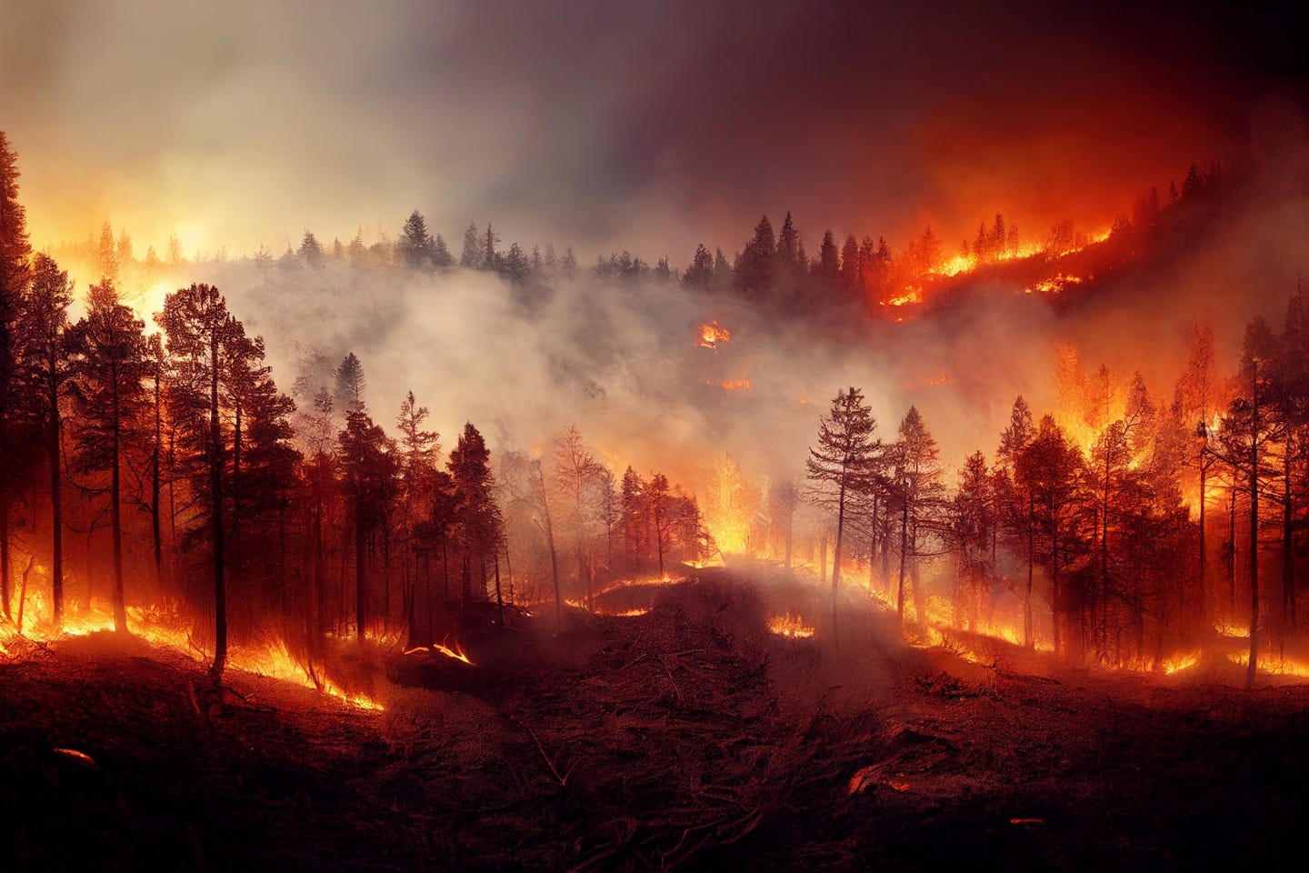
University of Minnesota researchers have developed AI-powered drone swarms to track wildfire smoke in 3D, offering a better way to predict air pollution. (CREDIT: Shutterstock)
From the outside, wildfire smoke may look like a drifting gray cloud. But for scientists, these plumes are dynamic, complex, and potentially dangerous. They can stretch for hundreds of miles, impacting air quality, visibility, and public health. Until now, capturing accurate data on how these smoke particles move and behave has been one of the most difficult tasks in atmospheric science.
Researchers at the University of Minnesota Twin Cities have developed a groundbreaking way to observe and analyze wildfire smoke: a swarm of AI-powered aerial robots that can detect, track, and build 3D models of smoke plumes.
Unlike traditional drones, these small flying machines work as a team. They recognize smoke, fly directly into it, and take high-resolution images from multiple angles. Their mission is to help us better understand how smoke travels—an understanding that could reshape how we predict air pollution and respond to environmental hazards.
This new study, published in the peer-reviewed journal Science of the Total Environment, opens doors to more accurate fire behavior models and better air quality predictions, not just for wildfires, but also for prescribed burns, volcanic eruptions, sandstorms, and other particle-driven events.
A Growing Crisis Meets High-Tech Tools
Between 2012 and 2021, about 50,000 prescribed burns were carried out in the United States—intentional fires set under controlled conditions to improve forest health and reduce wildfire risk. But even controlled burns carry risk. According to a 2024 report by the Associated Press, 43 of these burns spiraled out of control and became wildfires.
These numbers, while small in percentage, matter deeply. That’s because smoke particles, especially the small ones, can stay in the air for days and travel far from their source. “A key step is understanding the composition of smoke particles and how they disperse,” explained Jiarong Hong, professor of mechanical engineering at the University of Minnesota and senior author of the study. “Smaller particles can travel farther and stay suspended longer, impacting regions far from the original fire.”
Understanding how these plumes evolve over time is essential for early hazard detection, public health responses, and emergency planning. Yet, traditional tools for studying smoke—like satellites, remote sensing, and Lidar—fall short. These tools lack the detail and flexibility needed to capture fast-changing flows of smoke, especially in rough terrain or remote regions.
Related Stories
- Lifesaving new gel significantly improves wildfire protection for homes and communities
- Meet Skydweller: The autonomous solar-powered drone that can fly for 3 months without landing
That’s where the new drone swarm steps in. These AI-enabled robots are designed to adapt to the smoke’s size and shape. They gather rich data in real time—something existing technologies can’t do affordably or efficiently.
The Science Behind the Swarm
The team’s drone system includes one manager drone and four worker drones. These drones aren’t just fancy flying cameras—they’re mini laboratories in the sky.
Each drone carries a 12-megapixel camera mounted on a three-axis gimbal for capturing smoke in motion. They are powered by long-lasting 6000 mAh batteries and guided by advanced flight controllers and NVIDIA Jetson processors. These processors allow the drones to recognize smoke in real time, adjust their paths, and capture the best angles for imaging.
When launched, the drones work together to fly around a smoke plume, snapping high-resolution images from multiple directions. These images are then grouped by time intervals and fed into a computer model using something called a Neural Radiance Field (NeRF). This advanced AI model helps turn 2D images into a realistic, detailed 3D reconstruction of the smoke plume.
This step is key. With the 3D model, researchers can analyze the shape, direction, and flow of the smoke over time. It gives them crucial data like volume, angle of movement, and dispersion speed—all critical for improving fire and smoke simulation tools.
Other cutting-edge AI techniques were considered, including Dynamic NeRF (D-NeRF) and RoDynRF, which are good at modeling motion. But these systems struggle with featureless subjects like smoke and require long training times. The drone swarm approach avoids those problems by directly capturing the data in the field.
“This approach allows for high-resolution data collection across large areas—at a lower cost than satellite-based tools,” said Nikil Nrishnakumar, the study’s first author and a graduate researcher at the Minnesota Robotics Institute.
From Research to Real-World Impact
The drone swarm has already been tested in field deployments and has shown promising results. With this system, the team can generate multiple 3D reconstructions over time, creating a time-lapse view of how a smoke plume changes in real-time. It’s like watching the plume evolve in 3D—a powerful tool for scientists and emergency responders.
But the benefits of this technology reach far beyond wildfire science.
“Early identification is key,” Hong emphasized. “The sooner you can see the fire, the faster you can respond.”
The drones could be used in other dangerous scenarios as well, including volcanic eruptions, dust storms, and even urban pollution events. Because the system is modular and cost-effective, it can be scaled up or down based on the size of the area being studied. This flexibility makes it a strong candidate for use by government agencies, environmental researchers, and emergency crews.
The next steps for the team involve making the system more autonomous and scalable. They’re now integrating fixed-wing drones with Vertical Takeoff and Landing (VTOL) capability. These new drones can fly longer distances—over an hour at a time—and don’t need a runway to take off. That opens the door to monitoring vast forests and hard-to-reach locations.
In addition, the team plans to explore Digital Inline Holography to improve particle characterization. This method could provide even deeper insights into what types of particles are present in a smoke plume and how they interact with the environment.
“We’re not just building tools,” Nrishnakumar said. “We’re laying the groundwork for smarter, faster, and safer responses to environmental hazards.”
A New Era of Smoke Science
Many modern simulation tools like FIRETEC and QUIC-Fire already exist to model how fires spread and how smoke particles behave. These systems use complex inputs—everything from fuel type and moisture to wind speed and topography. But even the best models have one major limitation: they need real-world data to validate their predictions.
That’s why the drone swarm matters so much. It provides the missing piece—real, time-sensitive, high-resolution data that can make these simulations more accurate and useful.
Until now, simulation models have struggled to work in areas without detailed 3D maps of vegetation and terrain. They also haven’t been able to compare their predictions with real-world smoke movement, especially in complex or fast-changing environments. The drone swarm changes that by creating accurate 3D ground truth models that can be used for comparison and refinement.
As the climate warms and wildfire risks rise, these tools may become vital to protecting both ecosystems and human health. With more than 40% of the U.S. population living in areas prone to wildfire smoke, this research couldn’t come at a better time.
This project was supported by the National Science Foundation’s Major Research Instrumentation program and conducted with the help of the St. Anthony Falls Laboratory. Along with Hong and Nrishnakumar, the research team included Shashank Sharma and Srijan Kumar Pal, also from the Minnesota Robotics Institute.
Note: The article above provided above by The Brighter Side of News.
Like these kind of feel good stories? Get The Brighter Side of News' newsletter.