Breakthrough technology automates traffic monitoring through AI and transit bus cameras
A novel method for tracking vehicles on public roads could enhance traffic systems and help travelers get to their destination faster.
[July 27, 2023: Tatyana Woodall, Ohio State University]
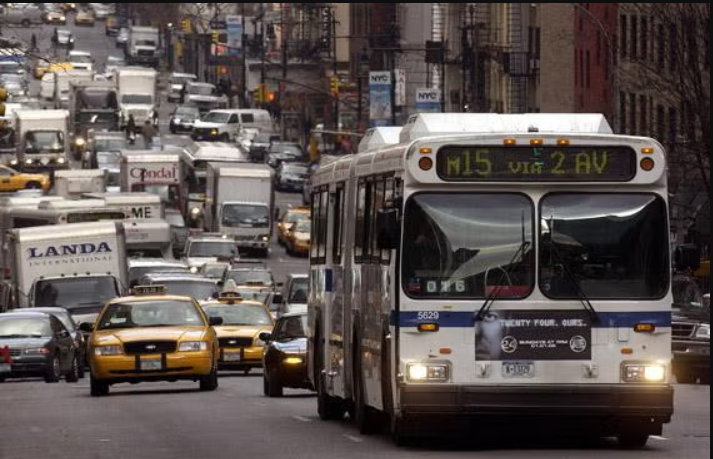
A novel method for tracking vehicles on public roads could enhance traffic systems and help travelers get to their destination faster. (CREDIT: Creative Commons)
Researchers have proposed a novel method for counting and tracking vehicles on public roads, a development that could enhance current traffic systems and help travelers get to their destinations faster.
Using the cameras already installed on campus buses at The Ohio State University, researchers demonstrated that they could automatically and accurately measure counts of vehicles on urban roadways, could detect objects in the road, and could distinguish parked vehicles from those that are moving.
In previous studies, Ohio State researchers found that using these mobile cameras provides much better spatial and temporal coverage than relying on sparsely and often temporarily placed sensors that don’t provide a view of many streets and roads in a city.
“If we collect and process more comprehensive high-resolution spatial information about what’s happening on the roads, then planners could better understand changes in demand, effectively improving efficiency in the broader transportation system,” said Keith Redmill, lead author of the study and a research associate professor of electrical and computer engineering at Ohio State.
Related Stories
Whereas researchers previously used human observers to manually identify the vehicles in the videos, this study, published in the journal Sensors, automates the process using AI.
According to co-authors of the study Mark McCord and Rabi Mishalani, both professors of civil, environmental and geodetic engineering at Ohio State, their team chose to utilize the traffic cameras on the Campus Area Bus Service partly because Ohio State’s large, interconnected campus resembles a small city and their relationship with CABS operators gave them ready access to the collected videos.
“Sharing access to our bus cameras for traffic monitoring is a great example of how university operations can support research and learning,” said Tom Holman, Ohio State’s director of Transportation and Traffic Management. “We are happy to share existing resources that can generate helpful data for long-term traffic planning purposes on campus and beyond.”
The proposed vehicle counting and trajectory extraction framework utilizes video cameras already mounted on existing transit buses for purposes other than traffic surveillance. Using transit buses as intelligent surveillance agents would thus be cost-effective and could increase traffic network coverage. (CREDIT: Sensors)
But what sets this study apart from similar traffic-related studies is that it utilizes available resources at no extra cost: bus cameras that have already been installed for other safety and security purposes. This allows it to be easily integrated into how other cities manage their traffic monitoring, said Mishalani.
“If we can measure traffic in a way that is as good or better than what is conventionally done with fixed sensors, then we will have created something incredibly useful extremely cheaply,” he said. “Our goal is to start building a system that could do this without much manual intervention because if you want to collect this information over lots of potential vehicles and lots of time, it’s worth fully automating that process.”
Overview of the proposed automated vehicle counting system. The objective is twofold: obtaining total bidirectional vehicle counts and extracting trajectories in bird’s-eye-view (BEV) coordinates. Our method uses streams of images, GNSS measurements, and predefined ROI information on a 2D map as inputs. The detection and tracking branch does not require geo-referencing, but it is necessary for counting and projecting trajectories in BEV world coordinates. The homography calibration needs to be performed only once. Only four point correspondences are required for the calibration process. (CREDIT: Sensors)
The system works by utilizing a state-of-the-art 2D deep learning model called YOLOv4 to automatically detect and track objects. The program is also uniquely adept at recognizing multiple objects in a single image frame, said Redmill.
While still a long way from total implementation, the study suggests the system’s results bear promise for the future of intelligent traffic surveillance. For example, besides counting vehicles, their algorithm is also able to project real-world bird’s-eye-view coordinates of the road network by taking advantage of streams of images, GNSS measurements, and regional information from 2D maps. It’s so precise, the system was also able to detect if the bus veered off from its planned route – and then report it to a map database that logs detailed information about the roadways, said Redmill, who is also a member of Ohio State’s Control and Intelligent Transportations Research Lab (CITR).
An example of a detected, tracked, and counted vehicle. The proposed system outputs bidirectional traffic counts. The segment ID indicates the current road segment occupied by the bus. (CREDIT: Sensors)
With widespread deployment and integration of their proposed approach, the vast collection and complete automation of processing of this data over time would allow for more effective planning, designing and operation of roadways to mitigate heavy traffic across the country. As for the benefits the public might see, such advancements in traffic surveillance could mean reduced travel times and greater travel choices when trying to get from point A to point B.
“Transportation planners, engineers and operators make vital decisions about the future of our roadways, so when designing transportation systems to work over the next 30 to 50 years, it’s imperative that we give them data that allows them to improve the efficiency of the system and the level of service provided to travelers,” said Mishalani.
The research was supported by the United States Department of Transportation’s Mobility21 University Transportation Center program. Other co-authors are Ekim Yurtsever and Benjamin Coifman, both of Ohio State.
Note: Materials provided above by Ohio State University. Content may be edited for style and length.
Like these kind of feel good stories? Get the Brighter Side of News' newsletter.