
UW researchers create the first building-level map of landslide risk across the United States
New research maps landslide risk across 128 million U.S. buildings, revealing who faces the greatest danger.
 UW Writer: William Poor

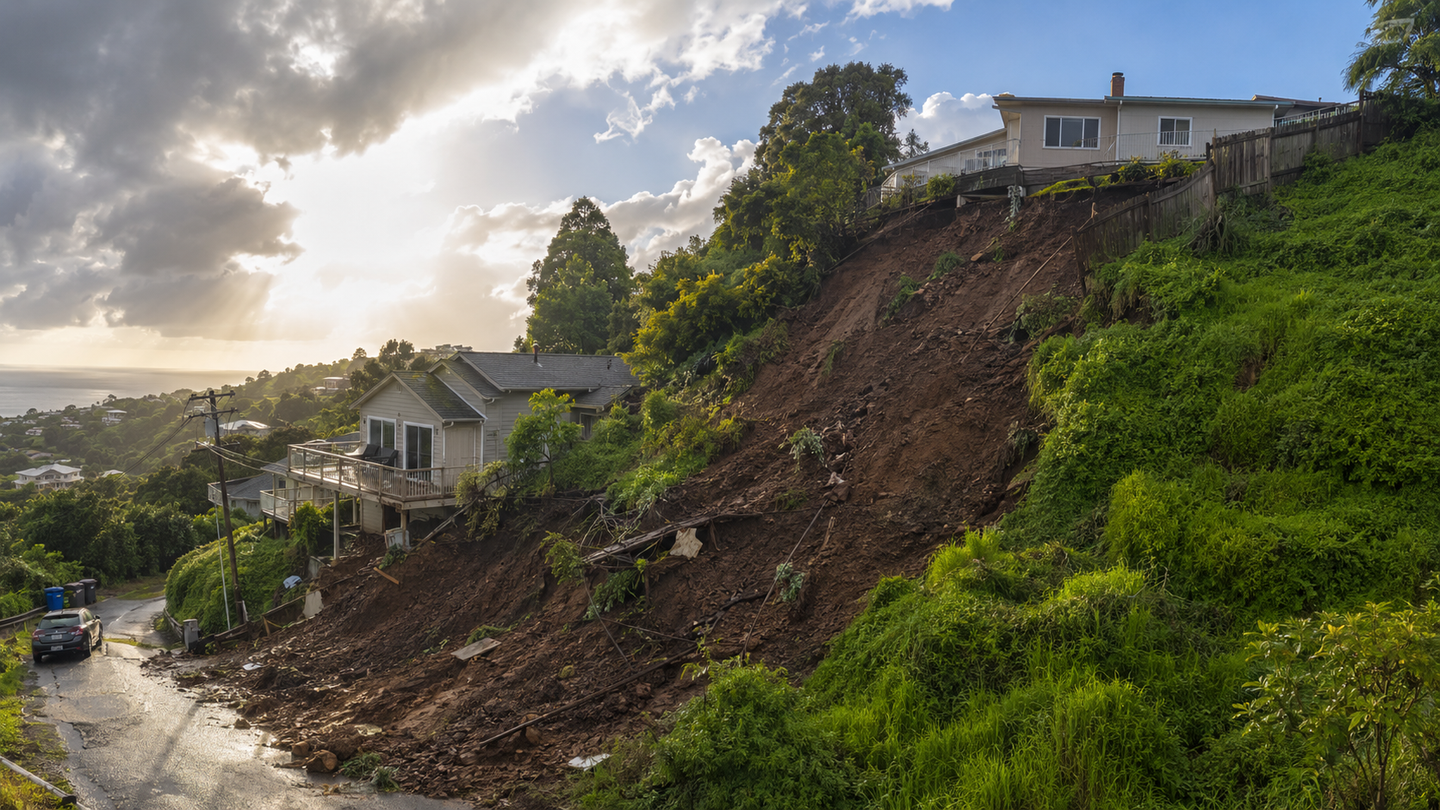
A nationwide database reveals where landslides threaten millions of Americans and highlights deep urban and rural divides in risk. (CREDIT: Shutterstock)
- Nearly 6.5 million Americans live in areas with the highest landslide risk, even though those areas hold only about 2 percent of the U.S. population.
- A new building-level database links landslide danger with income, transportation, disability, housing, and other factors that can shape disaster recovery.
- Rural communities, especially in Appalachia, often face the toughest combination of unstable terrain and limited resources, while many urban hillside neighborhoods have greater financial resilience.
A slow-moving disaster often begins with rain, silence, and shifting earth. Across the United States, landslides quietly reshape hillsides, damage homes, and sometimes take lives. Each year, they cause an estimated $3 billion to $6 billion in damage. Yet until recently, no one could say with precision who faces the greatest danger.
A new study from the University of Washington offers the clearest national picture yet. Researchers created the first building-level map of landslide exposure across the country, analyzing 128 million structures and linking them to terrain risk and social conditions. The result is the Landslide Exposure Database, a tool that reveals not only where landslides may occur, but also who is most vulnerable when they do.
“As a community of landslide researchers, we have spent almost all of our time studying the physical geography of landslides,” said Joseph Wartman, a professor of civil and environmental engineering at the University of Washington. “But we never considered the human geography. Now we can answer some very important questions about who is exposed.”
A National Hazard Comes Into Focus
Landslides often feel like isolated events, tied to steep hills or heavy storms. The new research shows a broader truth. Nearly 20 percent of land in the United States is prone to landslides. Yet only about 2 percent of the population, roughly 6.5 million people, lives in the highest-risk areas.
This uneven distribution matters. It means landslide danger is concentrated in specific regions rather than spread evenly across the country. Most at-risk residents live in two main areas: along the West Coast and throughout the Appalachian region.
The Appalachian Highlands alone account for more than half of the exposed population. The terrain there, with steep slopes and narrow valleys, limits where communities can build. As a result, many homes sit on unstable ground.
On the West Coast, exposure clusters in cities and coastal ranges. Areas such as the San Francisco Bay region and parts of Washington and Oregon show higher concentrations of at-risk buildings. In these places, development often meets steep terrain.
West Virginia stands out. The study found it has the highest share of residents living in landslide-prone areas. In contrast, California has a larger total number of exposed people due to its size, even though a smaller percentage of its population faces high risk.
Mapping Risk Down To Each Building
To build the database, researchers combined several large datasets. They used terrain maps from the United States Geological Survey, building footprints from national mapping projects, and census data that describes social and economic conditions.
The process required careful work. It was not simply a matter of merging data. Each dataset had to be aligned and cleaned to ensure accuracy.
“This effort was much more than just merging massive datasets,” said Daniel Acosta-Reyes, a doctoral student at the University of Washington and lead author of the study. “The real work was the careful curation required to turn the incredibly rich data available in the U.S. into an accurate, usable tool for everyone from decision makers to the public.”
The final product rates each building by its likelihood of being affected by a landslide. It also connects that risk to factors such as income, disability, access to transportation, and housing conditions.
This combination allows researchers to go beyond physical hazard. It shows how risk intersects with daily life.
A Divide Between Urban And Rural Communities
One of the study’s most striking findings is the difference between urban and rural exposure.
In rural areas, landslide risk often overlaps with economic hardship. Communities in these regions tend to have fewer resources to prepare for disasters or recover afterward. Homes may be located far from emergency services, and residents may lack transportation or financial support.
In many rural regions, especially in Appalachia, exposure is shaped by necessity. People build where land is available, even if it carries higher risk. The landscape offers limited safe alternatives.
Urban areas show a different pattern. Cities often limit exposure by concentrating development in safer zones. However, when risk does appear, it tends to affect wealthier neighborhoods.
Landslide-prone areas in cities are often hillside communities with scenic views. These properties are highly valued, and residents typically have greater financial resources. When a landslide occurs, they are more likely to recover quickly.
Wartman described this contrast clearly. In rural areas, vulnerability is higher. In cities, “all of that flips on its head.”
Where Risk And Vulnerability Collide
The database reveals more than just where landslides may happen. It highlights where exposure and vulnerability overlap.
Researchers identified regions where both are high. These include central Appalachia, parts of the rural Southwest, and areas in Alaska and the Pacific Northwest. In these places, communities face both physical danger and limited capacity to respond.
The study also found that about 732,000 people living in high-risk areas fall below the poverty line. These populations often lack the resources needed to prepare for or recover from disasters.
At the same time, other regions show high exposure but lower vulnerability. These include parts of California and the Northeast. In these areas, residents may have stronger financial support systems and better access to emergency services.
This contrast shows that landslide risk is not just about where you live. It is also about what resources are available when disaster strikes.
Testing The Data Against Real Events
To confirm the accuracy of their model, researchers compared the database with real-world landslides.
In Seattle, they examined a record of more than 600 landslides. The database successfully identified all buildings that were affected. Most of these structures fell into high or moderate risk categories.
A second test came from Hurricane Helene, which triggered nearly 2,000 landslides in North Carolina. The database captured about 91 percent of buildings impacted by the event.
These results show that the tool can accurately identify areas of concern. However, researchers noted some limits. Landslides can travel beyond steep slopes, affecting buildings in areas that appear safe on maps.
Why The Risk Is Growing
The study comes at a time when landslide risk is expected to increase. Climate change is bringing more intense rainfall, one of the main triggers of slope failure. At the same time, housing demand is pushing development into riskier areas.
Together, these trends could raise both the number and severity of landslides in the future.
The new database provides a way to prepare for that future. It allows governments and emergency planners to target resources where they are needed most.
Moving Beyond One Size Fits All Solutions
The findings suggest that landslide policy must be tailored to local conditions.
In rural Appalachia, solutions may focus on early warning systems and community outreach. These approaches can help reach dispersed populations and reduce risk before disaster strikes.
In cities such as Seattle or San Francisco, policy may center on land-use regulations. Limiting construction on unstable slopes can prevent future damage.
Other regions may require a mix of strategies, including infrastructure investment, relocation programs, and education efforts.
The key insight is that no single solution will work everywhere. Effective policy must reflect the unique mix of geography and social conditions in each region.
A Tool For Communities And Individuals
Beyond its use for policymakers, the database offers value to everyday residents. It provides a way for people to check their own exposure and better understand the risks they face.
“People email me because they want to know if their homes are at risk, and I haven’t had a resource to point them to,” Wartman said. “That was a big part of the motivation for this work. Now I have something straightforward to offer them.”
The database is publicly available, with tools designed for non-experts. This accessibility helps turn complex data into practical knowledge.
Practical Implications Of The Research
The Landslide Exposure Database has the potential to reshape how the United States prepares for and responds to landslides. By identifying both where hazards exist and who is most vulnerable, it allows for smarter allocation of resources.
Government agencies can use the data to prioritize funding for mitigation projects, early warning systems, and emergency planning. Communities can develop targeted strategies that reflect their specific risks rather than relying on broad national policies.
For researchers, the database opens new avenues for studying how natural hazards interact with social systems. It provides a foundation for future work on climate impacts, land use, and disaster resilience.
For individuals, the tool offers a clearer understanding of personal risk. This knowledge can guide decisions about home ownership, insurance, and preparedness.
Ultimately, the research supports a more proactive approach to disaster management. Instead of reacting after landslides occur, communities can plan ahead, reduce exposure, and protect lives.
Dig deeper into U.S. landslide risk and community vulnerability
These resources examine where landslides are most likely, how often they occur, how extreme rainfall and climate change affect the hazard, and how communities can better manage and prepare for the risk.
Parsimonious High-Resolution Landslide Susceptibility Modeling at Continental Scales
Using more than 613,000 documented landslides and high-resolution elevation data, researchers developed a nationwide susceptibility map that captured 99% of observed landslides while revealing hazardous terrain overlooked by older, coarser models. (AGU Advances, 2024)
Constraining landslide frequency across the United States to inform county-level risk reduction
This national analysis estimates how frequently landslides occur across U.S. counties and identifies major concentrations along the West Coast, Appalachians, Pacific Northwest, Alaska, and other mountainous regions, providing another layer for evaluating local risk. (Natural Hazards and Earth System Sciences, 2025)
Assessing the impact of climate change on rainfall-triggered landslides: a case study in California
Researchers examine how changing rainfall patterns could alter landslide activity in California, helping clarify how climate-driven shifts in extreme precipitation may affect communities already exposed to unstable slopes. (Landslides, 2025)
Effective landslide risk management in era of climate change, demographic change, and evolving societal priorities
This review examines how climate change, population shifts, development, vulnerability, and changing public priorities complicate landslide risk management, emphasizing the need for approaches tailored to local social and physical conditions. (Landslides, 2025)
Preliminary Field Report of Landslide Hazards Following Hurricane Helene
USGS scientists document the widespread landslides triggered by Hurricane Helene in western North Carolina, including their distribution, impacts, and relationship to extreme rainfall, offering a detailed look at the type of Appalachian disaster highlighted in the story. (U.S. Geological Survey, 2025)
Research findings are available online in the journal Earth's Future.
The original story "UW researchers create the first building-level map of landslide risk across the United States" is published in The Brighter Side of News.
Related Stories
- AI helps predict dangerous fire conditions in modern homes
- UC Irvine's new map predicts which California homes are most likely to burn in a wildfire
- Thunderquakes turn storms into a new tool for imaging underground hazards
Like these kind of feel good stories? Get The Brighter Side of News' newsletter.
Joseph Shavit
Writer, Editor-At-Large and Publisher
Joseph Shavit, based in Los Angeles, is a seasoned science journalist, editor and co-founder of The Brighter Side of News, where he transforms complex discoveries into clear, engaging stories for general readers. With vast experience at major media companies like The Los Angeles Times, Times Mirror and Tribune Publishing, he writes with both authority and curiosity. His writing focuses on space science, planetary science, quantum mechanics, geology. Known for linking breakthroughs to real-world markets, he highlights how research transitions into products and industries that shape daily life.